|
|
|
|
|
|

)
|
 "Bonneville Flood Melon Gravel - Click to view")
|
 "Red Rock Pass - Click to view")
|
 "Shoshone Falls - Click to view")
|
 "Lake Bonneville historical marker - Click to view")
|
 "White Pelican swims near melon gravels - Click to expand. image")
|
- Click thumbnails to enlarge -
|
LAKE |

|
|
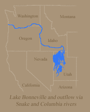
Imagine an ice-age lake in Utah whose surface area roughly equaled that of Lake Michigan. Also imagine that same ice-age lake releasing a surge of floodwater whose volume was six times the flood flow of the Mississippi River. Since no humans witnessed this event we can only picture it in our minds. But the lake and its destructive outflow were not someone's imaginary fantasies. Geologists know that it was all very real. After geologic processes millions of years ago created the unique basin-and-range topography of the western Rocky Mountains, an immense basin dominated the landscape of western Utah. Exactly when the body of water--later named Lake Bonneville--began to form is uncertain. The evidence indicates that it existed at least 600,000 years ago. As the climate became cooler and wetter, Lake Bonneville expanded in size, gradually spreading over a surface area of about 20,000 square miles and overlapping into Nevada and Idaho. Because Lake Bonneville was in a basin, it lacked natural outlets. Once captured, water from rainfall, stream flows, and glacial melting remained in the lake, except for those amounts lost through evaporation. At its greatest extent, the lake level stood at 5,090 feet elevation--nearly 1,000 feet higher than the current level of Great Salt Lake. Distinct shorelines, including sand and gravel beaches, were formed along the 2,000 miles of Lake Bonneville's rim. Animals such as bears, camels, deer, mammoths, horses and musk oxen roamed its shores. In addition to being confined by higher ground at the basin rim, a "natural dam" at Lake Bonneville's northern limit at Red Rock Pass prevented outflows. The pass [ south of Downey, Idaho, on U.S. 91 ] was the site of overlapping alluvial fans--huge deposits of rock, sand, and soil that had eroded during the weathering-down of nearby mountains. | ||
About 17,400 years ago, this natural --but unstable--dam gave way.Play Bonneville Flood Slideshow
|
|
Red Rock Pass, Idaho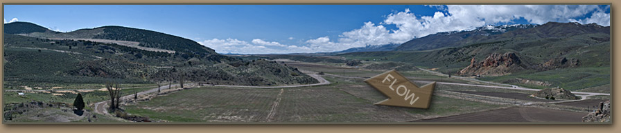
THE CATACLYSMIC BONNEVILLE FLOOD
|
|
VISIBLE | ||||||||||||||||
|
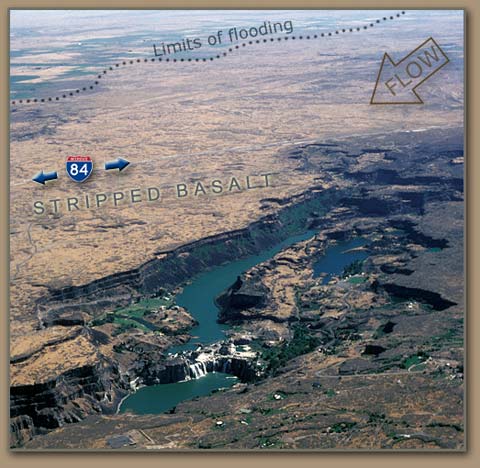
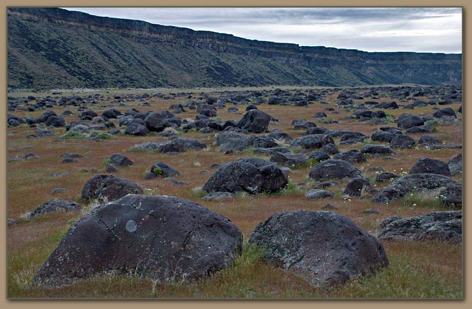
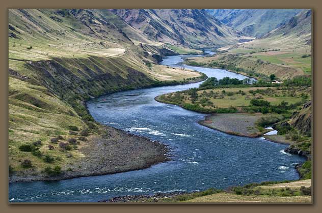
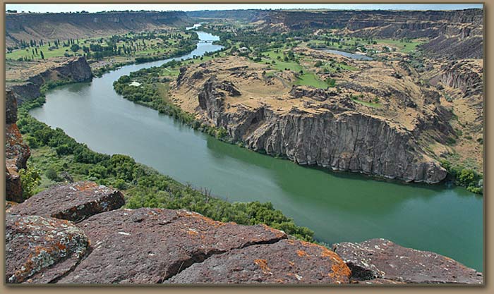
Lake Bonneville shorelines....The pre-flood shoreline at 5,090 feet elevation is clearly visible as a terrace-like terrain feature in nearby mountain ranges, such as the Wasatch in northeastern Utah. The post-flood shoreline at 4,700 feet elevation is less prominent but also discernible. Scablands and sand and gravel deposits.....Authors William and Elizabeth Orr [in Geology of the Pacific Northwest] described the process as "hydraulically vacuuming up millons of tons of rock" and then depositing the materials downstream. The flood stripped surface material in the Snake River plain, creating scablands visible northeast of Twin Falls, Idaho and a region of sand and gravel deposits near Burley and Rupert, Idaho. Huge boulders ripped loose by the flood were deposited at Massacre Rocks State Park [near Exit 28 on Interstate 86 southwest of American Falls]. Snake River Canyon.....The existing canyon was deepened in places, creating the spectacular Shoshone Falls and Twin Falls northeast of the city of Twin Falls, Idaho. Northwest of the city are several examples of alcoves--or "dry falls"--at Devil's Washbowl, Devil's Corral, and Blue Lakes.
 | ||||||||||||||||||
|
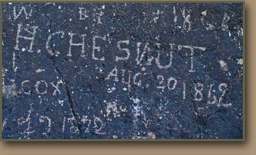
The 101 Ranch along US HWY 30 appears to be looking for help removing basalt boulders from their pasture near King Hill, ID. The material was ripped from bedrock upstream, then tumbled by floodwaters before being dropped near this location. |
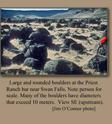
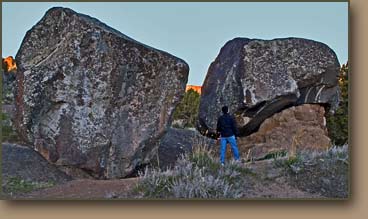
 Surrounding images show flood-tumbled boulders below Swan Falls Dam. 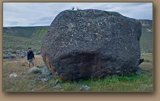 |
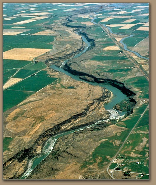
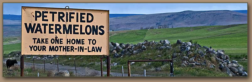
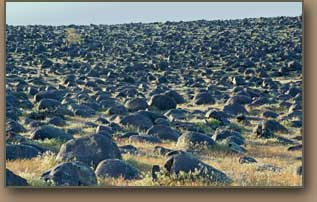
Melon Gravels.....As the water ripped through narrow reaches of the Snake's canyon, it dislodged large basalt boulders and tumbled them downstream. Within a few miles these boulders had been rounded with diameters ranging from three feet to ten feet. The process created large bars of sand and boulders, some of them several miles long and nearly 300 feet high. These remnants were given the name melon gravels after geologists observed a billboard that advertised one patch of boulders as "petrified watermelons." Impressive deposits of melon gravels can be found near Hagerman; in Malad Gorge; in Melon Valley south of Wendell; at Swan Falls south of Melba; and near the towns of Hammett, Glenn's Ferry and King Hill. 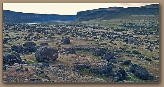 |
RESOURCES:Harold E. Malde- Geological Survey Professional Paper (1968 - 73 pages) The Catastrophic Late Pleistocene Bonneville Flood in the Snake River Plain, Idaho "A study of colossal features of erosion and deposition produced along the Snake River by sudden overflow of Lake Bonneville" Open Benjamin Crosby's 2011 Bonneville Flood Guidebook[20.88 MB] and page of links to Bonneveille Flood Papers.
 |
 |
 |
Trip ReportMay 2010 hike to view Bonneville Flood features in Hells Canyon: Area covered: Pittsburg Landing, Kirkwood, Suicide Point and Big Bar |
|
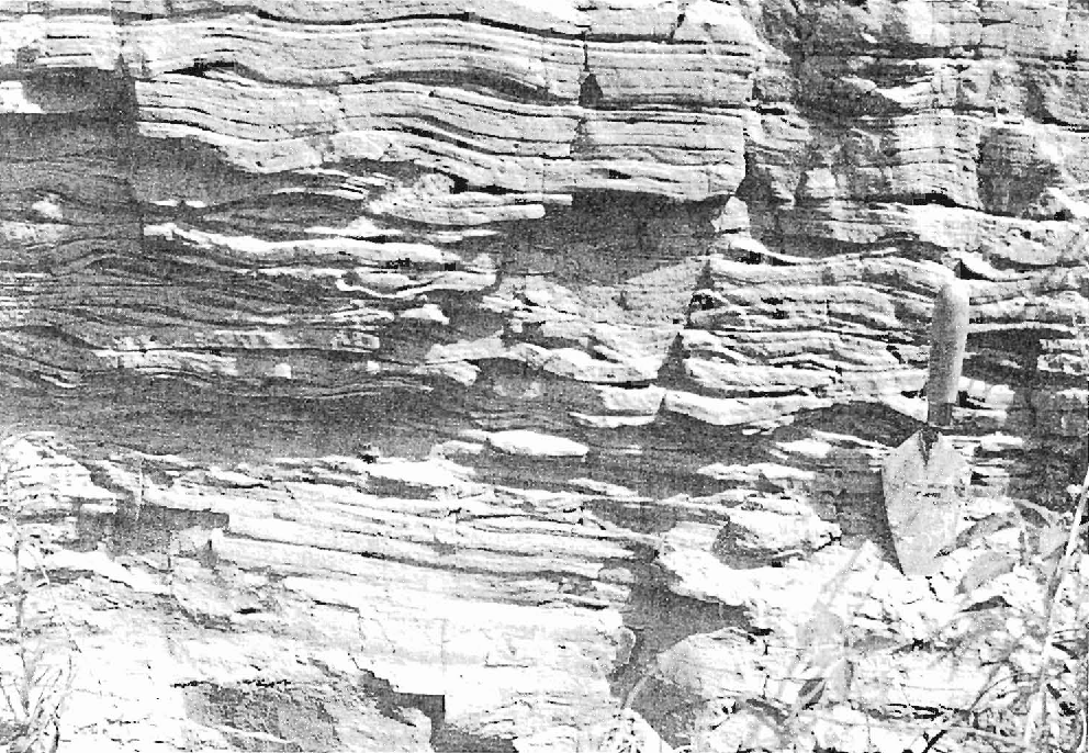
At Tammany Bar south of Lewiston, Idaho - Bonneville Flood gravels (B) are capped with Lake Missoula Floods rhythmites (M) 2-20 feet thick. The Missoula sand and silt deposits were backflooded to this location when Ice Age floodwaters temporarily reversed the Snake River's course. |
 |
|
|
|
THE AFTERMATH |
|
|
The most intense flooding occurred over a period of several days--at most, several weeks, but over spilling at Red Rock Pass may have continued for as long as a year before the lake stabilized at 4,700 feet--the so-called "Provo shoreline"--and remained at that level for at least 600 years.
As the Ice Age ended the climate became warmer and drier. With less rainfall and glacial melting to sustain Lake Bonneville, coupled with increased evaporation, the vast lake began to retreat. The current Great Salt Lake's drainage area is roughly that of ancient Lake Bonneville. Other prominent remnants include Utah Lake, Sevier Lake, and the Great Salt Lake Desert.
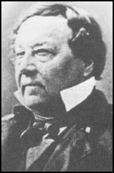
BENJAMIN BONNEVILLE |
|
Lake Bonneville was named for Benjamin L. E. Bonneville, a French-born U.S. Army officer, who in the 1830s was involved in exploring and trading ventures in the Pacific Northwest. Geologist G.K. Gilbert was the first to study these prehistoric lake features, and he decided to honor Captain Bonneville in this way. Learn more about Lake Bonneville and the Bonneville Flood: |
 |
EXPLORING SOUTHERN IDAHOPeople who want to visit the Snake River region to see for themselves the evidence of the Bonneville flood and other geologic wonders in the area, may find David Alt and Donald Hyndman's Roadside Geology of Idaho to be a helpful guide. |
 "Balanced Rock near Buhl, ID - Click to expand image")
| |
 "Craters of the Moon - Click to expand image")
|  "Click to enlarge image")
| |

 "Click to enlarge image")