HUGEfloods.com Home Page Not much time? ... Click here for a quick Ice Age Floods summary Ice Age Floods Feature of the month For many years one man understood the clues but no one would listen Glacial Lake Missoula Channeled Scablands of Eastern Washington Temporary Lake Lewis Columbia Gorge Explore the variety of features created by the Ice Age Floods Columbia River Basalt Group The Pleistocene Grand Coulee Dam and the Columbia Basin Irrigation Project Washington Wines Ice Age Floods Institute

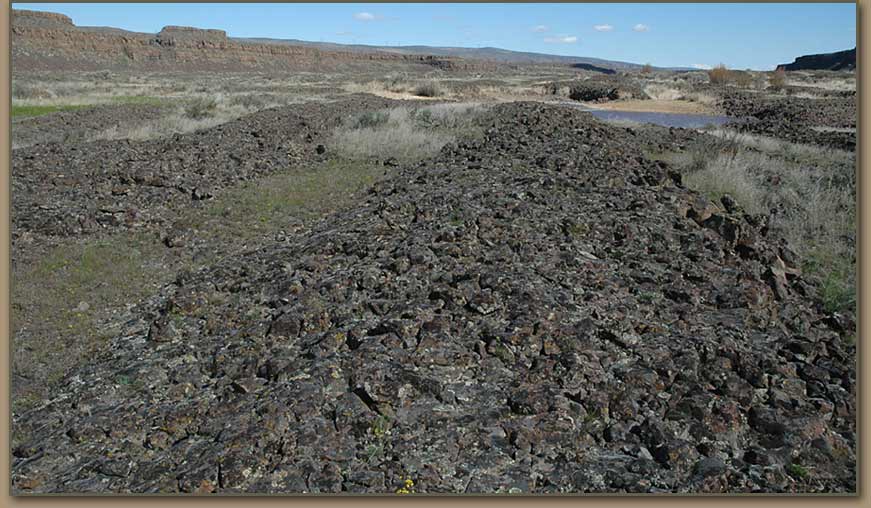
Longitudinal Grooves - Cut by the Ice Age Floods

Satellite image controls are active. Use your mouse to navigate.


Satellite view of longitudinal grooves near Dry Falls. Blue line included to show angle of grooves.

longitudinal groove: long parallel grooves eroded into rock benches and mesas in areas with extreme velocities and turbulance associated with the Scabland floods. (Bjornstad)


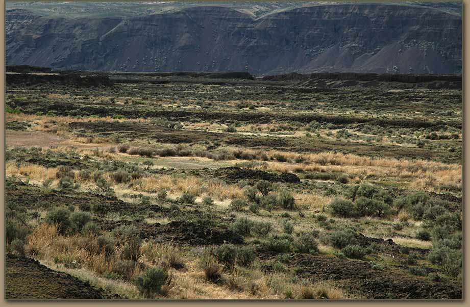
Longitudinal Grooves are described in Bruce Bjornstad's book, On the Trail of the Ice Age Floods.


All photos by Tom Foster unless otherwise noted.

HOME Space CONTACT Space SITE MAP IAFI Space LINKS Space © 2008

Ellensburg
Lake Missoula
Lake Lewis
Ice Age Blog
Ice Age Express
Feature of the Month
The Mystery
25 Features
Channeled Scablands
Ice Age Floods Videos
Columbia Gorge
Feature Types
Columbia River Basalt
The Pleistocene
Grand Coulee Project
Washington Wine
Ice Age Floods Inst.
The Bonneville Flood