
|
|
|
|
|
|


  |
|
||||
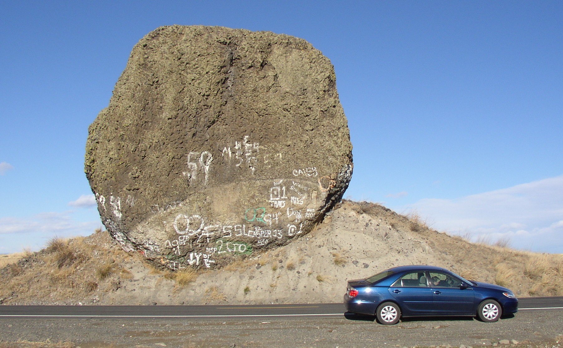
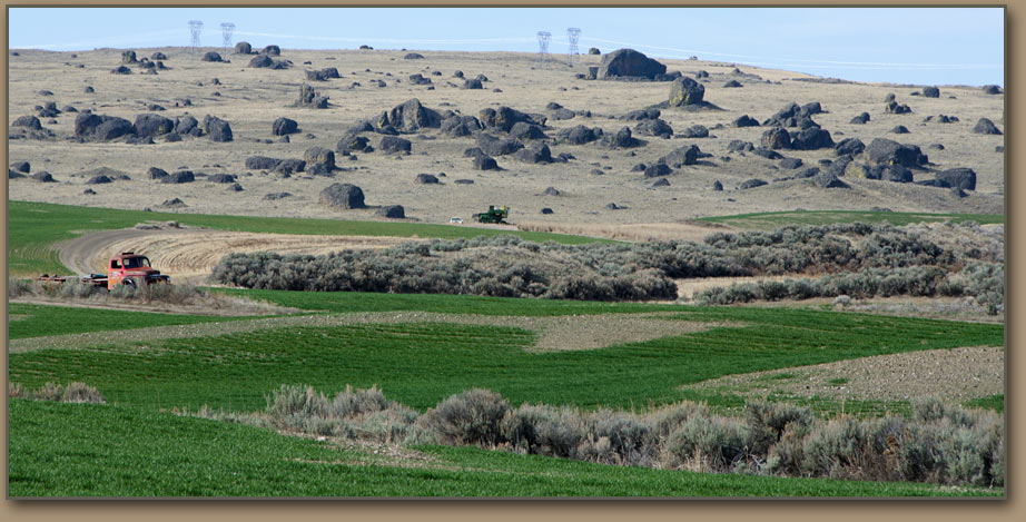
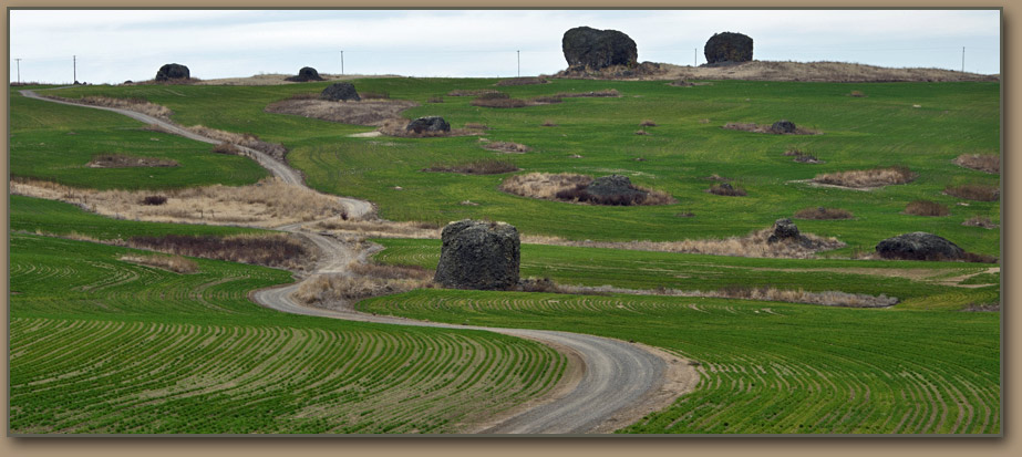
Glacial Debris - North Central Washington | |||
 | |||
WHAT CAUSED THE GLACIERS?When dealing with water, scientists speak of the “hydrologic cycle.” A primitive description can be found in the biblical Book of Ecclesiastes: “All the rivers run into the sea; yet the sea is not full; unto the place from whence the rivers come thither they return again.” If only it were that simple. Water exists as liquid, solid, or vapor. There is a finite total amount. Water is either impounded in oceans, lakes and ponds…moving in rivers or underground aquifers…temporarily invisible as vapor until it returns to the surface as precipitation…or is trapped as ice. During the later stages of the Ice Age so much water had been transformed into glacial ice that the world’s oceans were 300 feet lower than they are today. The impact may have been more dramatic at an earlier stage of the Pleistocene Epoch, because evidence suggests that at one time the oceans were 450 feet below modern levels. For the hydrologic cycle to be so dramatically altered by glacial activity, only two factors matter. The climate must be wet enough to generate considerable precipitation. The climate also must be cool enough that winter snowfall exceeds summer snowmelt. Lingering snowfall eventually compacts into glacial ice. Cold weather by itself won’t create an ice age. | 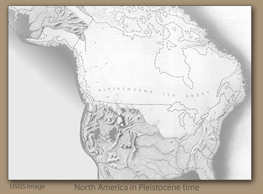 | ||
|
Therefore, at the onset of the Pleistocene Ice Age the Earth’s climate changed enough so that the interplay of temperature and precipitation triggered the expansion of glacial activity. Fluctuations in these conditions caused the periodic advances and withdrawals of the ice masses. There is no fully-accepted view of what caused the climate change. Some scientists believe that the Earth’s orbit around the Sun undergoes periodic minor fluctuations that are sufficient to create climate conditions like these. For many years students were taught that there were four major glacial outbreaks. It is now believed that there were at least eight, and perhaps as many as 20. Since the later glacial extensions would have eradicated most evidence of the earlier ones, precise knowledge may always elude researchers. | |||
Geology of Seattle and the Puget Sound video
WISCONSIN GLACIATION IN THE PACIFIC NORTHWEST | |||
|
The Ice Age floods—at least the ones we know about—were products of the Wisconsin glaciation, which began about 100,000 years ago and ended about 10,000 years ago. In addition to the Lake Missoula floods of 15,000-20,000 years ago, it is believed that even more cataclysmic floods took place between 50,000-60,000 years ago. Less is known about Glacial Lake Columbia, which roughly amounted to a greatly-expanded version of modern day Lake Roosevelt—which consists of the water impounded behind Grand Coulee Dam. It is believed that during the Wisconsin glacial era Lake Columbia’s surface was about 1,000 feet higher than today’s surface elevation of Lake Roosevelt. Geologists also think that Lake Columbia was not subjected to periodic catastrophic floods caused by ice dam failures. |
| ||
|
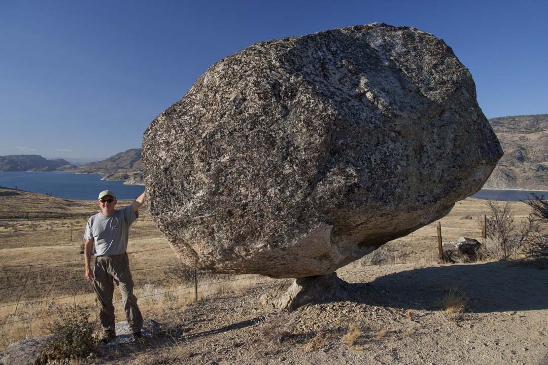
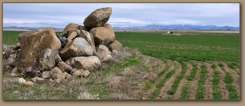
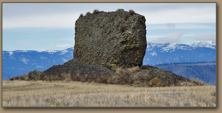
Lake Columbia was formed as a result of blockage created by a lobe of an ice sheet that spread down the Okanogan Valley, crossed the Columbia River, and then spread over 500 square miles of the Waterville Plateau. Advancing glaciers push huge accumulations of rocks and soil in front of them. When glaciers later retreat these mounds, some of them hundreds of feet high, remain as evidence in the form of “terminal moraines.” Withrow Moraine, west of Dry Falls and north of U.S. Highway 2, marks the southernmost reach of the Okanogan glacial lobe. It seems clear that Grand Coulee and Moses Coulee were not formed entirely by the Lake Missoula floods, but initially were scoured by meltwater and runoff from Lake Columbia at an earlier time. Overflow water from Lake Columbia occupied Grand Coulee between flood events. However, substantial flood episodes were involved in the phenomenal natural feature of Dry Falls, near Coulee City. Dry Falls is a three-mile-wide complex of cataracts that during the Ice Age dropped water 400 feet. The force of floods and runoff was sufficient to dislodge basalt columns forming the lip of the falls. Over time the falls “retreated” 15 miles northward through Grand Coulee. Another glacial lobe in northeastern Washington created Lake Spokane, which at times may have been an extension of Lake Columbia. The glacial lobe which filled the Purcell Trench in the Idaho panhandle—and provided Lake Missoula’s ice dams—was 20 miles wide. Nearly all of the higher mountains in northwest Montana had large glaciers on their slopes during the Ice Age, and the glaciation was so extensive that it almost represented a continuous ice sheet. An extension of the Rocky Mountain Trench of British Columbia contained an immense valley glacier that was 6,000 feet deep at the U.S.-Canada border. Other glacial lakes may have been formed as the result of ice dams especially in the channel of the Kootenai River. West of the Cascade Range, meanwhile, thick glacial ice sheets penetrated southward into the broad valleys of the Puget Sound lowlands--which at that time were dry land, except for several rivers. The southernly limit of the ice mass was reached a few miles beyond today's Olympia. Ice Age meltwater and runoff drained westward to the Pacific Ocean via the Chehalis River gap. Glaciers filled and leveled the region, gouging out channels and trenches that later would become such terrain features as Puget Sound, Lake Washington and Hood Canal. Ice-borne "erratic" rocks from British Columbia have been found in the low country east of Puget Sound and on the islands within the sound and Admiralty Inlet. A number of hills and lesser mountains west of the main stem of the Cascades had their tops rounded by the advancing ice, which was 2,500 feet deep as far south as Seattle. Huge chunks of ice separated from the ice masses and were buried among the sediment deposited during the Pleistocene Epoch. As this buried ice eventually melted--a process that extended over many years--the result was a number of depressions in the landscape known as "Kettles."
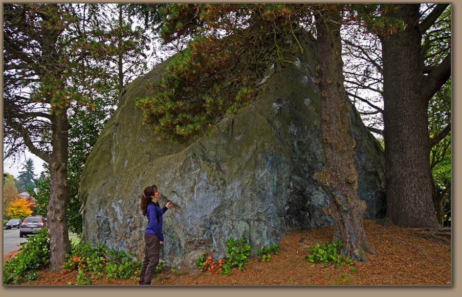 The Wedgewood Erratic was placed at this location [NE 72nd Street and 28th Avenue NE] by the Vashon Glacier. Other large Puget Sound area erratics are described in blog posts by Dave Tucker. THE GLACIERS RETREATThe Ice Age encompassed two million years of amazing events which helped shape the geography and geology of the Columbia Basin. What surprises scientists the most is how abruptly it ended. Within a geologically brief time span of about 5,000 years the glaciers retreated to approximately their present ranges. Ocean levels had been raised to their modern shorelines by 10,000 years ago—when the Ice Age ended. 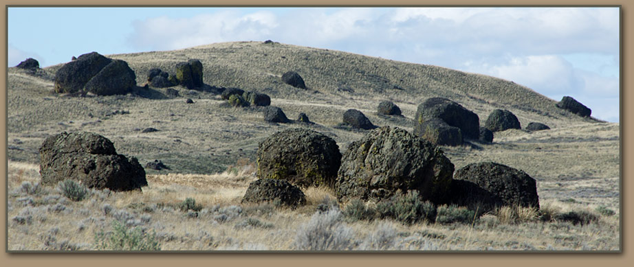
| |||

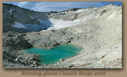 |
For current status of glacial ice in the North Cascades visit:GLACIER CLIMATE PROJECT |
