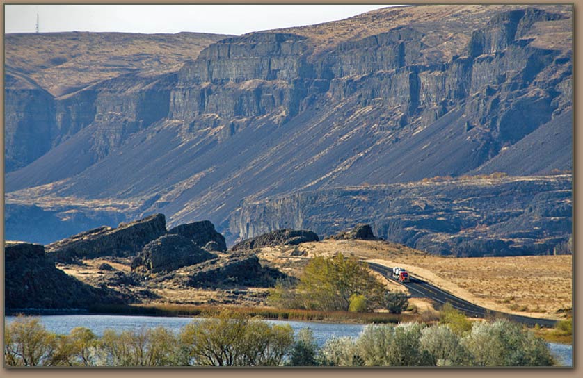
HUGEfloods.com Home Page Not much time? ... Click here for a quick Ice Age Floods summary Ice Age Floods Feature of the month For many years one man understood the clues but no one would listen Glacial Lake Missoula Channeled Scablands of Eastern Washington Temporary Lake Lewis Columbia Gorge Explore the variety of features created by the Ice Age Floods Columbia River Basalt Group The Pleistocene Grand Coulee Dam and the Columbia Basin Irrigation Project Washington Wines Ice Age Floods Institute

"CHANNELED SCABLANDS"


THE COLUMBIA BASIN’S “CHANNELED SCABLANDS”

The unflattering term “scablands” sometimes is applied to rough or barren regions with little or no economic potential – especially for agriculture. The esteemed analyst of the Columbia Basin scablands –geologist J Harlen Bretz—used the term “channeled scablands “ because he saw clear evidence that this strange landscape had been created by monster Ice Age floods which had gouged channels through it. This distinguishes the Columbia Basin from tracts of scablands [or badlands] elsewhere, in which the topography normally results from the effects of massive long-term erosion.

"I could conceive of no geological process of erosion to make this topography except huge, violent rivers of glacial meltwater...It was a debacle which swept the Columbia Plateau."

J Harlen Bretz

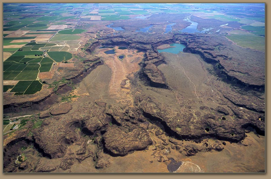
That part of Washington which contains the channeled scablands is defined roughly as follows: The northern boundary is the plateau region which begins south of Lake Roosevelt and the Spokane River from Grand Coulee to a few miles west of Spokane. The western limit follows Grand Coulee to the town of Soap Lake, then to the Columbia River near Quincy, and south along the Columbia to the Saddle Mountains. The eastern boundary approximates an imaginary line from Spokane south to where State Road 127 crosses the Snake River. The southern limit is the Saddle Mountains from Mattawa to Othello, and then an imaginary line running southeast from Othello to the Snake River.

This is a vast expanse of real estate. But while it contains the channeled scablands, only part of it actually rates as scabland. Bretz estimated that there are 2,000 square miles of scablands within the region. However, in their book Cataclysms on the Columbia, authors John Elliot Allen and Marjorie Burns include 1,500 square miles in only that part of the overall scablands region south and east of Interstate 90 and U.S. 395 from Spokane to Ritzville and Pasco. Allen and Burns do not offer an estimate for the square mileage of scablands elsewhere in the Columbia Basin, but their calculation would suggest a larger overall total than Bretz’s.

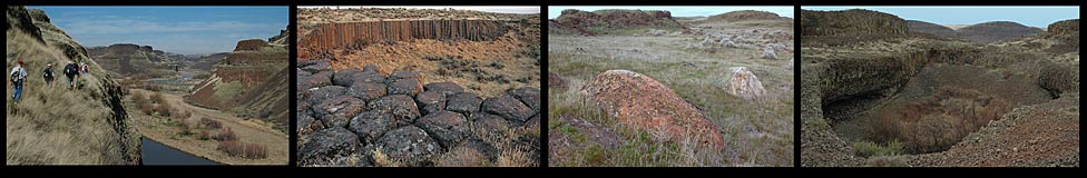
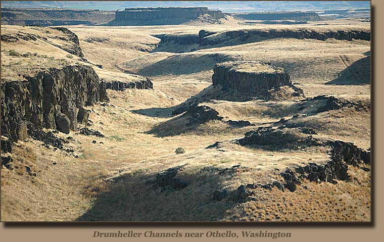
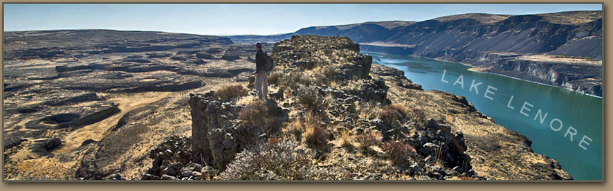
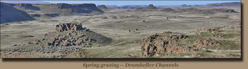
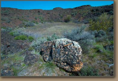
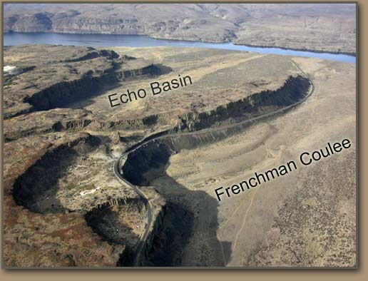
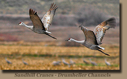
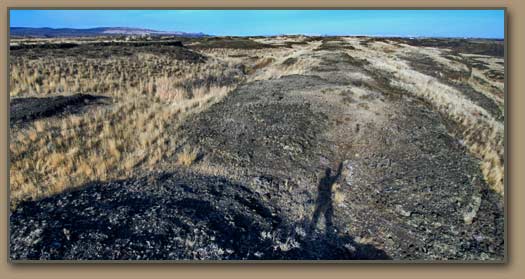
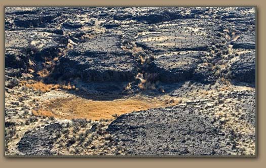
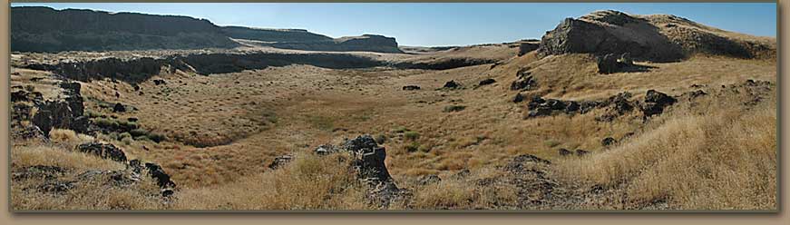
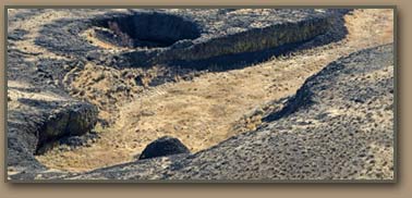
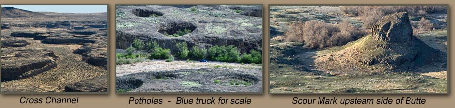
Many areas within the above boundaries clearly are not scabland. The rounded Palouse-type hills which retained topsoil in spite of the floods are intensively used today for grain production. A belt of these hills north of Interstate 90 between the town of Sprague and the city of Moses Lake provides one example. The eastern fringe of the scabland region is a mixture of Palouse hills and scablands. Certain coulee valleys qualify geologically as scabland, but enough soil from nearby hills has eroded into them that they, too, are farmed. A motorist driving Interstate 90 between Moses Lake and George, Wash., will observe little or nothing out of the ordinary while passing among field of sweet corn, potatoes, peas, alfalfa, or mint. Tracts of scabland such as those southwest of Sprague Lake or in the Drumheller Channels [south of Potholes Reservoir], however, are only fit for cattle grazing and isolated hay fields.


SCABLAND CHARACTERISTICS

The channeled scablands were created where the Ice Age floods accelerated across the tilted surface of the Palouse slope, causing massive erosion. Much of the eroded sediment was carried all the way to the Pacific Ocean.

Rattlesnake Channeled Scablands

The most visible landmarks are the region’s coulees. These features are steep-walled canyons which either lack any active streams or contain streams so puny that they couldn’t have been responsible for the scale of erosion needed to gouge the coulees. The channels in the coulee floors represent an interconnected pattern of braiding. An exception is Grand Coulee, whose lower segment between Coulee City and Soap Lake is filled by a chain of lakes, and whose upper reaches are the dammed impoundment of Banks Lake.
Among the other more impressive landforms of this type are:

  • Moses Coulee, which stretches for more than 40 miles from Mansfield to the Columbia River near Rock Island.


  • The complex of canyons through which Coal Creek and upper Crab Creek flow between Harrington, Odessa, and Wilson Creek [traversed by State Road 28].


  • Washtucna Coulee between Connell and Washtucna [State Road 260].


  • Frenchman Coulee on the Columbia’s east bank north of the Interstate 90 bridge at Vantage, as well as Potholes Coulee, about five miles upriver from Frenchman Coulee.


  • Lower Crab Creek Coulee between the Frenchman Hills and Saddle Mountains [from Othello to the Columbia River just north of Sentinel Gap].

The scablands also contain what geologists call butte-and-basin topography. The massive floods scoured lengthy grooves in the underlying basalt, and then gouged out potholes and rock basins. Subsequent flooding created vertical walls of basalt which became temporary cataracts and then dry waterfalls. These dry falls receded as each successive flood ripped basalt columns from their forward edges.

Two prominent examples of butte-and-basin topography are the Drumheller Channels and the Palouse Canyon.

Designated as a National Natural Landmark, the Drumheller Channels south of Potholes Reservoir fill a square containing more than 60 square miles of channel’s buttes, and basins. J Harlen Bretz identified 150 distinct channelways and 180 rock basins in this area. The channels are 400 feet lower than the surrounding buttes. [Drumheller’s lakes and marshes are the destination of vast numbers of migrating Sandhill Cranes which visit the region each spring.]

When the Ice Age floods diverted the Palouse River from its former course through Washtucna Coulee, the new waterway carved a deep 11-mile scabland canyon north of the Palouse River’s junction with the Snake River. Coulees, abandoned spillways, buttes, and recessional cataracts dominate the landscape. Palouse Falls has retreated about five miles up the canyon due to the series of Lake Missoula floods. The falls are an impressive sight and may be viewed from an overlook at Palouse Falls State Park, north of the State Road 261 bridge crossing the Snake River at Lyons Ferry.

Another feature of the Channel Scabland are numerous lakes, ponds, and dry depressions. As the floodwater gouged troughs in the basalt, swirling eddies known as “kolks” plucked chunks of basalt from the channel beds. Later floods widened them. South of Sprague Lake is an extensive region which shows kolk effects. Kolk lakes and depressions also are common near Sun Lakes State Park and the Drumheller Channels.