Add featured video locations to map
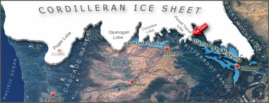 Move your mouse over image to remove Glacial Lakes and Ice Sheet.
NASA base image shows eastern Washington's Channeled Scabland from space. Major scabland tracts are identified: Moses Coulee (1), Grand Coulee (2), Telford-Crab Creek (3) and Cheney-Palouse (4). Another ice sheet (Laurentide) east of the Rocky Mountains - extended south to about same latitude as the Cordilleran sheet. Illustration does not show alpine glaciers that were feeding down into ice sheet from the mountain ranges.
|


