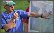
Bruce Bjornstad on the Trail of the Ice Age Floods.
HUGEfloods.com Home Page Not much time? ... Click here for a quick Ice Age Floods summary Ice Age Floods Feature of the month For many years one man understood the clues but no one would listen Glacial Lake Missoula Channeled Scablands of Eastern Washington Temporary Lake Lewis Columbia Gorge Explore the variety of features created by the Ice Age Floods Columbia River Basalt Group The Pleistocene Grand Coulee Dam and the Columbia Basin Irrigation Project Washington Wines Ice Age Floods Institute

Bruce Bjornstad leads Ice Age Floods Institute field trip.

Bruce leads IAFI
field trip.

Interview: Bruce Bjornstad

Bruce Bjornstad, a Research Scientist based in Richland, Washington, is the author of the popular ‘On the Trail of the Ice Age Floods’ guidebooks.


Nick Zentner interviews Ice Age Floods expert Bruce Bjornstad.


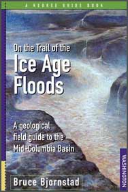
On the Trail of the Ice Age Floods.

Book Info


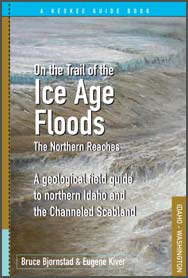
On the Trail of the Ice Age Floods - The Northern Reaches.

Available
soon

Guidebook cover
art by
Stev H. Ominski


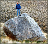
Bruce Bjornstad on Ice Rafted erratic - Pasco Basin.

Pasco Basin erratic boulder. [Kleinkenecht photo]

In an interview recorded on August 7, 2007 at Central Washington University, Bruce Bjornstad visits Ellensburg to discuss his efforts to promote understanding and appreciation of eastern Washington’s Channeled Scablands through his popular book ‘On the Trail of the Ice Age Floods’.

A former Eastern Washington graduate student who studied under geology professor Gene Kiver (a charter member of the Ice Age Floods Institute), Mr. Bjornstad works at the Pacific Northwest National Laboratory on weekdays – and spends many weekends working on Ice Age Floods outreach. As a Research Scientist at the Hanford Site, Bruce is part of a scientific team that models groundwater flow through the Ringold Formation (pre-Missoula Floods sediments) and the Touchet Beds (Missoula Floods sediments).

Later in the interview, Bruce discusses finding a publisher for his book, On the Trail of the Ice Age Floods: A geological field guide to the Mid Columbia Basin. Keokee Books – based in Sandpoint, Idaho – published Bruce’s work in 2006. The book explores the origins, timing and frequency of the Ice Age Floods and describes each of 19 geologic features that were left behind. Illustrated with more than 200 maps, schematics, photos and illustrations, including 16 pages of color plates, On the Trail of the Ice Age Floods provides a clear, concise and easily useable guide to the remarkable geologic record of the great Ice Age floods.

Late in the interview, Bruce outlines his involvement with the Ice Age Floods Institute - a nonprofit, grassroots organization that focuses on outreach to the citizens of the Pacific Northwest, and comments on a proposed National Geologic Trail. Bruce regularly gives lectures and leads field trips to signature Ice Age Floods landmarks such as Palouse Falls, Dry Falls, Wallula Gap, and Frenchman Coulee.


Bruce has placed geocaches near many significant Ice Age Flood features in the mid-Columbia.


Bjornstad Geocache Sites

- Bruce Bjornstad's Research -

Pacific Northwest National Laboratory

Bruce Bjornstad hikes along Grand Coulee rim.
- Trip Report -

Bruce Bjornstad on Umatilla Rock - Dry Falls State Park.
- Trip Report -


Slideshow by Bruce
Photographs of the great Ice Age (Missoula) floods of the Pacific Northwest.
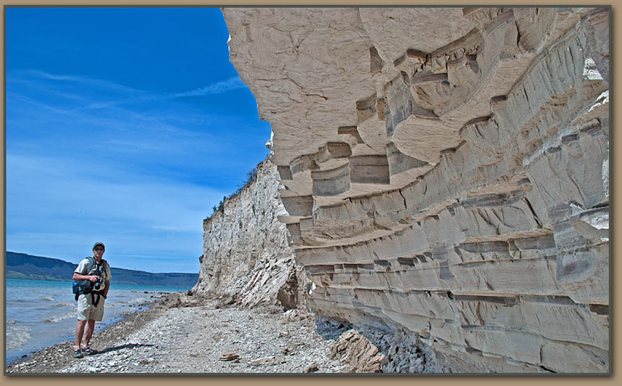
Geologist Bruce Bjornstad stands near Glacial Lake Columbia deposits in the Grand Coulee.

These rhythmically bedded layers of mostly silt were deposited in Glacial Lake Columbia (backwaters from Okanogan Lobe ice dam) at the end of the Ice Age within upper Grand Coulee. Each bed of Lake Columbia silt, also known as a varve, is believed to represent an annual layer of sedimentation. Up to several hundred of these varves overlie the last outburst flood deposits from Glacial Lake Missoula suggesting the Okanogan Ice Lobe and Glacial Lake Columbia hung around for several centuries after the last Missoula megaflood.

Grand Coulee and Lake Columbia silt are featured in an upcoming book by Bruce Bjornstad and Gene Kiver - "On the Trail of the Ice Age Floods: The Northern Reaches".


FREE full length geology programming -

View more "Central Rocks" episodes related to the Ice Age Floods:

Taped on the campus of Central Washington University and hosted by CWU Geology Professor Nick Zentner, 'Central Rocks' is a series of interviews with geologists who teach or conduct research in Washington. 'Central Rocks: Roadside Geology', a new spin-off project, is a series of short films that feature familiar locations along Washington's scenic highways.

Geologist Jim O'Connor - Click to open video link.
Jim O'Connor

USGS Hydrologist Jim O'Connor discusses current research on Washington's Missoula Floods and Idaho's Bonneville Flood.
Geologist Gene Kiver - Click to open video link.
Gene Kiver

EWU Geology Professor Gene Kiver discusses the origins of the Ice Age Floods Institute.
Nick Zentner interviews Ice Age Floods expert Dr. Victor R. Baker.
Vic Baker

UA Geology Professor Vic Baker discusses his distinguished career devoted to Washington's Channeled Scablands.
Geologist Nick Zentner - Click to open video link.
Nick Zentner

CWU Geology Professor Nick Zentner lectures on eastern Washington's unique landscapes (Floods of lava and floods of water).
All photos by Tom Foster unless otherwise noted.
Screenshots courtesy "Central Rocks"

HOME Space CONTACT Space SITE MAP IAFI Space LINKS Space © 2008
Ellensburg
Lake Missoula
Lake Lewis
Ice Age Blog
Ice Age Express
Feature of the Month
The Mystery
25 Features
Channeled Scablands
Ice Age Floods Videos
Columbia Gorge
Feature Types
Columbia River Basalt
The Pleistocene
Grand Coulee Project
Washington Wine
Ice Age Floods Inst.
The Bonneville Flood