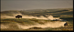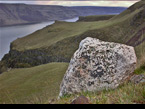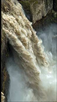
Palouse Falls panorama Bitterroot Blooms Giant Current Ripple - Camas Prairie Montana Glacial Lake Missoula Bison Ice Rafted Erratic Wallula Gap
HUGEfloods.com Home Page Not much time? ... Click here for a quick Ice Age Floods summary Ice Age Floods Feature of the month For many years one man understood the clues but no one would listen Glacial Lake Missoula Channeled Scablands of Eastern Washington Temporary Lake Lewis Columbia Gorge Explore the variety of features created by the Ice Age Floods Columbia River Basalt Group The Pleistocene Grand Coulee Dam and the Columbia Basin Irrigation Project Washington Wines Ice Age Floods Institute


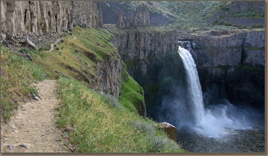
Palouse Falls Kayak.
Palouse Falls


Discover the Ice Age Floods

The catastrophic floods from Glacial Lake Missoula and Lake Bonneville
are among the largest known floods in geologic history

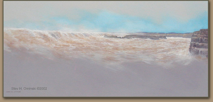
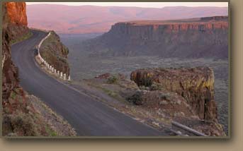
Ice Age Floodwater flows over the area known today as Dry Falls.
Image shows Ice Age Floodwaters flowing through Lower Grand Coulee.
Information about the artist: Stev H. Ominski

THE ICE-AGE FLOODS LEFT STARK EVIDENCE OF THEIR PASSAGE

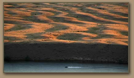
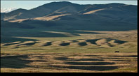
In addition to the mammoth coulees of eastern Washington, direct evidence of the floods exist in several forms. Giant current ripples, such as those at West Bar, near Quincy, Wash., and at Camas Prairie, Mont., offer some of the most conclusive proof that the massive flooding occurred.


Other flood-caused phenomena include massive bars of sediment at various locations along the Snake and Columbia rivers ... scoured buttes, basins, and potholes of the scablands ... impressive recessional cataracts at Dry Falls and Palouse Falls ... and boulders transported hundreds of miles on ice rafts.


What's new at HUGEfloods.com. Recent updates related to Lake Missoula, Lake Bonneville and the Ice Age Floods.

Updated: April 2016

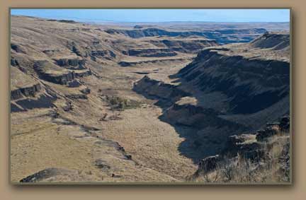
Ice age flood channel, eastern Washington.
The Ice Age Floods etched many deep canyons and coulees into the Columbia River Basalt that blankets much of eastern Washington.

Gary and his crew can use your help at Palouse Falls State Park!!!

Trail Planning, Palouse Falls State Park.

One of several Franklin County trails in the Palouse River Canyon and Palouse Falls. Photo taken on 23 April 2016.

This is an important time at Palouse Falls State Park - Washington State Parks will be developing a trail plan and and seeks public involvement. Sign posted at park reads: "Washington State Parks will be developing a trail plan for Palouse Falls State Park. If interested in participating in the survey and planning, please leave contact information in the park pay box or call 509-337-6457".

Click image below to play video.

Ice Age Floods video describes the Missoula Floods, Bonneville Flood and the Columbia River Basalt Group

More "2 Minute Geology" Videos

Glacial Lake Missoula

CREATED WHEN AN ICE DAM BLOCKED THE FLOW OF THE CLARK FORK RIVER


GLOBAL COOLING THEN BRINGS AN ONSLAUGHT OF ICE-AGE GLACIERS

Between 2 million and 2.5 million years ago a combination of cooler temperatures and increased precipitation formed massive ice sheets which repeatedly advanced and retreated as climate conditions fluctuated. Ice coated the Puget Sound lowlands, and most of the mountain regions of northern Washington, Idaho and Montana. So much glacial ice existed that the oceans were 300 feet lower than they are today. The final episode was the Wisconsin glaciation, a cycle that took place from 100,000 years ago until about 10,000 years ago.

ICE DAMS BLOCK MOUNTAIN VALLEYS, CREATING SUPER-RESERVOIRS

As the ice sheets pushed southward from Canada they interrupted normal stream flows in the deep valleys of the mountainous Pacific Northwest. One protrusion, the Okanogan Lobe, created Lake Columbia, which was a super-sized version of modern Lake Roosevelt. An ice mass clogging the Purcell Valley of Idaho's panhandle blocked the outflow of the Clark Fork River, forming Glacial Lake Missoula. Other impoundments included a lake near Spokane, Wash. Scientists believe that additional lakes existed in Washington, Montana and British Columbia.
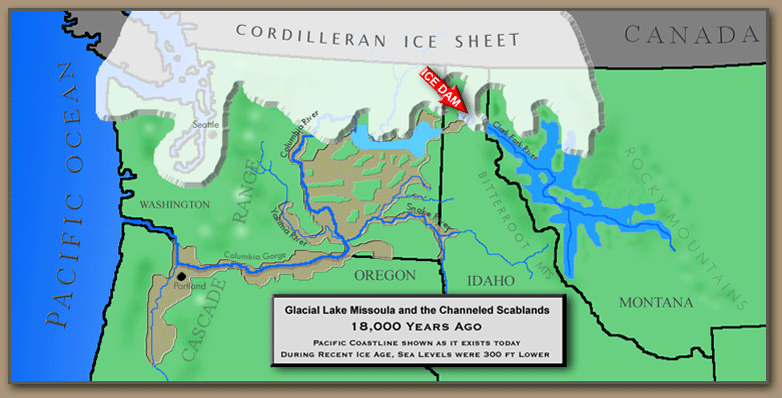
Map showing Glacial Lake Missoula and the Ice Age Floods Region.

LAKE MISSOULA BECOMES A CATALYST FOR A CATASTROPHE

The ice blockage in the Purcel Valley gradually collected tremendous volumes of water in the deep valleys of western Montana, creating a gigantic reservoir which attained a depth of 2,000 feet and impounded over 500 cubic miles of water--equivalent to the combined volumes lakes Erie and Ontario. The natural ice dam periodically failed, which caused a catastrophic emptying of Lake Missoula. After each dam failure, the southward moving ice sheet then created a new one, and the cycle repeated itself. At least 40 major flood episodes originated from Lake Missoula.


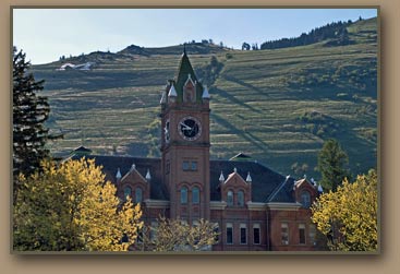
Glacial Lake Missoula strandlines behind Main Hall at University of Montana.
Glacial Lake Missoula's wave-cut shorelines are visible on Mount Sentinel behind the University of Montana's clock tower (Main Hall). The lake's maximium depth at the site of present-day Missoula was 950 feet.
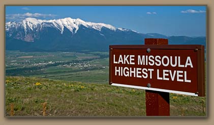
Sign marks higest level of Glacial Lake Missoula (National Bison Range).
Lake Missoula's maximum level (4,300 ft. elev.) is marked at the National Bison Range - Saint Ignatius, MT and Mission Mountains in the distance. The valleys of western Montana held over 500 cubic miles of water.

FLOOD TORRENTS DRASTICALLY ALTER THE LANDSCAPE

Each ice dam failure released a torrent of of water hundreds of feet deep, which swept southwesterly--gouging the huge coulees of eastern Washington, ripping out sediment and basalt rock, and stripping soil and vegetation from thousands of square miles of land in the Columbia Basin. Some of the debris was carried by the floods all the way to the ocean. One flood pathway created the Grand Coulee. A second poured into the lowlands around Ephrata, Moses Lake and Othello. A third flowed along the western fringe of the Palouse Hills, removing vast amounts of fertile topsoil. More than 2,000 squre miles of so-called "scablands" were created. Each flood episode added to the impact.

Frenchman Coulee, carved by the Ice Age Floods.
Frenchman Coulee

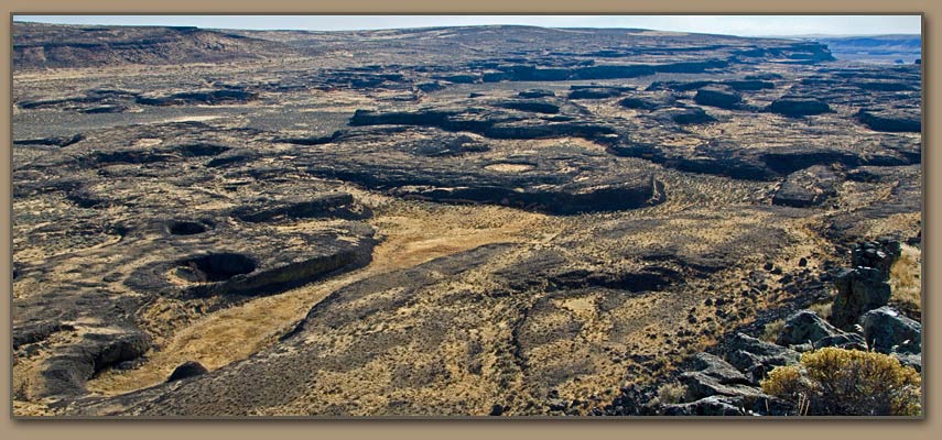
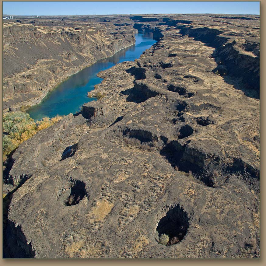
Drumheller Channels near Othello, Washington.
Channeled Scablands
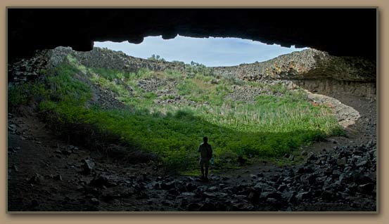
Pothole scoured out by the Ice Age Floods.
Hiker stands on the floor of a large pothole that was drilled into the basalt by violent whirlpool-like currents known as kolks.
Ice Age Floodwaters from Lake Missoula and other sources created huge coulees..
Scabland Channel cut by Glacial Lake Missoula floodwater.

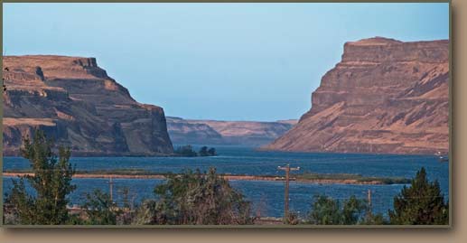
Walluala Gap restricted Ice Age Floods, creating Lake Lewis.
Wallula Gap

WALLULA GAP STEMS THE DELUGES TEMPORARILY

The Lake Missoula floods overwhelmed everything in their path until they reached the choke point at Wallula Gap in the Horse Heaven Hills range south of Pasco, Wash. Floodwaters backed up throughout the Pasco Basin and Yakima and Walla Walla valleys. The result was a temporary impoundment known as Lake Lewis, which existed for only a few days after each major flood episode. During its brief existences Lake Lewis put 3,000 square miles of land under water, and the lake was more than 800 feet deep in Pasco.

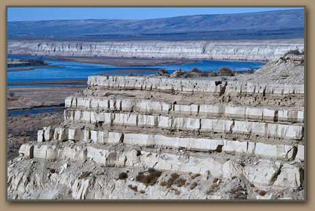
Ice Age Floods rhythmite exposure at White Bluffs.
Ice Age Flood rhythmites (foreground).

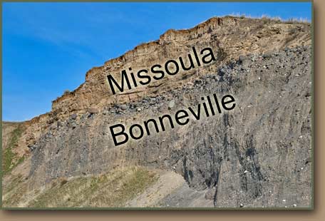
Multiple Lake Missoula deposits cap Bonneville Flood material.

At Tammany Bar south of Lewiston, Idaho - Bonneville Flood gravels are capped with Lake Missoula Floods rhythmites 2-20 feet thick. The Missoula sand and silt deposits were backflooded to this location when Ice Age floodwaters temporarily reversed the Snake River's course.

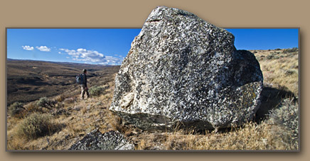
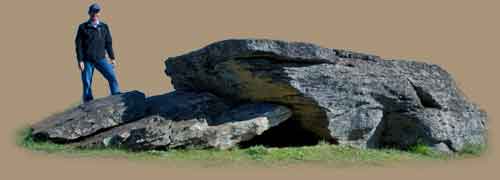
Ice Age Floods erratic boulder in eastern Kittias County.
Erratic boulder rafted to this location within iceberg.
[Kittitas County, WA - N. of Ginkgo State Park]

Giant Current Ripples along Columbia River (West Bar).
Giant Current Ripples were created by deep, fast moving water.
[Columbia River boat for scale]

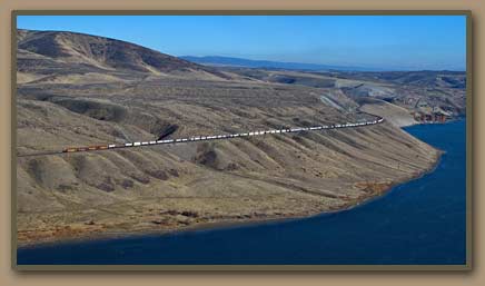
Moses Coulee Bar.
Huge gravel bar below Moses Coulee mouth.
[Train for scale]

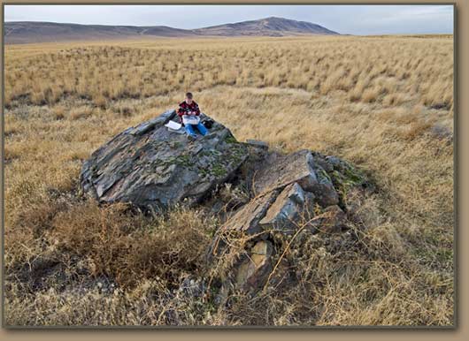
Ice Age Floods erratic Pasco Basin.
Luke (nephew) examines geocache contents while sitting on ice-rafted erratic boulder (Rattlesnake Mountain in distance).

The argillite boulders (pictured above) consist of material that was part of an ancient seabed more than a billion years ago and later involved in the uplift of the Rocky Mountains.

During the most recent Ice Age, the rocks became trapped within glacial ice in British Columbia or northern Idaho. That ice was picked up and carried into the Pasco Basin by an Ice Age Flood from Glacial Lake Missoula. Note: B.C. material would have been moved south within glacial ice - Into the path of Lake Missoula floodwaters.


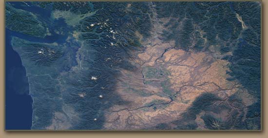
Satellite image of Washington State
NASA images show path of the Ice Age Floods

- Click to enlarge satellite image -

Tom Tabbert flying trike.

Google Earth and Google Maps are excellent tools for anyone wishing to explore the Ice Age Floods region.


Columbia Basin vegetable harvest.

Pasco Basin Pea Harvest

Following development of the Columbia Basin Irrigation Project and other systems, the area once inundated by the waters of Lake Lewis encompasses some of the most productive farmland in the world. Slackwater flood sediments mixed with windblown deposits combine to create fertile well-drained soils with the capacity to produce high value crops. Channels cut by the Ice Age Floods created the opportunity to store and move irrigation water.


Columbia Gorge

WALLS OF WATER THEN RAGE THROUGH THE COLUMBIA GORGE

Water volumes exceeded the capacity of the gorge near today's John Day Dam, creating another impoundment which backflooded into the Dalles and Umatilla basins. Surging water gouged the walls of the gorge to their modern near-vertical alignment, thereby creating the complex of waterfalls at the gorge's west end. Patches of scabland were created near the Dalles and extensive sand and gravel bars were dropped into the valleys of tributary streams.

THE FLOODS RUSH TO THE OCEAN, WHILE BRIEFLY DROWNING THE WILLAMETTE VALLEY

Another check point at Kalama caused the floods to form another temporary lake which flooded the Willamette Valley as far south as Eugene, Ore. Large lowland tracts in Washington across the river from Portland also were underwater. The flood crests then dropped rapidly as they reached Astoria and the Ice-Age seacoast 40 miles west of that modern city. Flood debris has accumulated to a depth of 800 feet in the Columbia River's bed west of Astoria.

Multnomah Falls, Columbia Gorge.
Multnomah Falls
Many spectacular waterfalls are found in the Columbia Gorge. The steep walls of the gorge were shaped by Ice Age Floods.

Willamette Valley Ice Age Floods erratic rock.
A large iceberg carried the Bellevue Erratic over Eastern Washington and down the Columbia Gorge during one of the largest Ice Age Floods. The iceberg then drifted into the flooded Willamette Valley where it grounded on hillside, standing this 40-ton erratic southwest of Portland, OR.

ICE AGE FLOODS MYSTERY

The idea of catastrophic flooding ran counter to the conventional wisdom of scientists, but over a 30-year period geologist J Harlen Bretz proved that the remarkable natural features of the Columbia Basin could only have occurred in this way. Fellow geologist Joseph T. Pardee identified the role of Lake Missoula in the process.

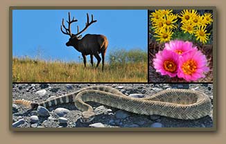
Ice Age Flood region wildlife.
Diverse habitats within the flood region are home to a wide variety of plants and wildlife. Mission Valley elk (MT), Drumheller Channels rattlesnake (WA), Columbia Basin wildflowers (WA).

LAKE BONNEVILLE FLOOD

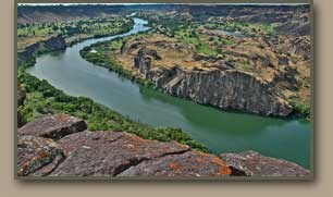
Snake River Canyon

Another Ice-Age phenomenon was Lake Bonneville, which during that era covered much of northern Utah as precipitation and meltwater gradually filled a large natural lowland. The lake eventually attained a surface area roughly equal to modern Lake Michigan, and a depth of more than 1,000 feet, because it had no natural drainage outlets. Unlike Lake Missoula, ice dams were not an issue at Lake Bonneville. Its most vulnerable point was a natural dam of alluvial material blocking Red Rock Pass in southeastern Idaho.

About 15,000 years ago that dam gave way and the level of Lake Bonneville dropped more than 350 feet in one spectacular episode. Over time about 1,000 cubic miles of water roared through the Snake River Canyon and emptied into the Columbia River near Pasco, WA. Stark evidence of the flood remains in the form of smooth displaced boulders (melon gravels), scablands and gravel bars. Utah's Great Salt Lake now occupies a portion of the land area once covered by Lake Bonneville.

More information and photos:
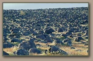
Lake Bonneville Flood

Basalt boulders tumbled by Bonneville Flood
- "Melon Gravel" -
Congress passes Ice Age Floods National Geologic Trail.

President Obama signed legislation in 2009 authorizinig the Ice Age Floods National Geologic Trail.

Ice Age Floods National Geologic Trail press conference. Gary Kleinkenecht, Doc Hastings and Maria Cantwell.
Ice Age Floods Institute President Gary Kleinknecht speaks during the Ice Age Floods National Geologic Trail press conference.
Ice Age Floods National Geologic Trail press conference. Doc Hastings and Maria Cantwell.

Congressman Doc Hastings and Senator Maria Cantwell hold small ice-rafted erratics that were presented by the Ice Age Floods Institute. Hastings and Cantwell were primary sponsors of the trail legislation.


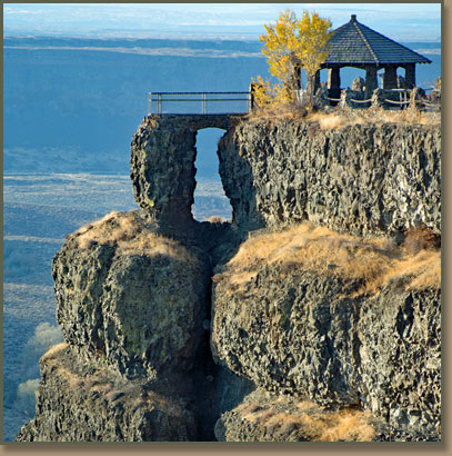
Dry Falls State Park - Ice Age Floods.
Dry Falls

HOW DO WE KNOW THAT THESE DRAMATIC FLOODS OCCURRED?

The pioneering research carried out by geologist J Harlen Bretz in numerous treks through the Columbia Basin region beginning in the 1920s convinced him that only huge floods--not normal erosion processes--could have wreaked so much havoc upon the area's landscape. But most leading geologists scoffed at his findings. Not until the 1950s, after additional research by Bretz, coupled with that of geologists Joseph T. Pardee, did opinions begin to change. Pardee proved that glacial Lake Missoula was the source of the floods. Bretz's controversial thesis was vindicated fully by the mid-1960s.


Deep Lake potholes at Dry Falls State Park.
Potholes (50 feet deep!) drilled into the basalt at Dry Falls State Park near Coulee City, WA. Deep Lake shown.


Dry Falls State Park vista house.
Observation Point - Dry Falls State Park


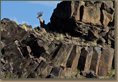
Deer on Columbia River Basalt in the Channeled Scablands
Scabland buck on Columbia River Basalt


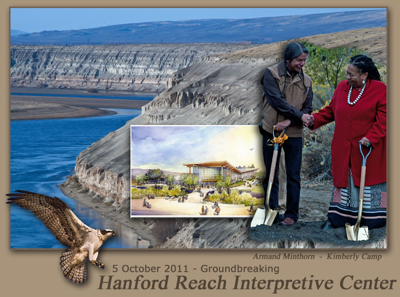
Hanford Reach Interpretive Center. Visit the REACH, Kimberly Camp and Armand Minthorn.

Hanford Reach Interpretive Center's Chief Executive Officer Kimberly Camp and Tribal spiritual leader Armand Minthorn (Confederated Tribes of the Umatilla Indian Reservation) were two of the nearly 200 that turned out for Phase 1 groundbreaking of the $40 million project. About $26 million has been raised so far.

The Ice Age Floods story has been identified as one of the key topics to be explained in 61,000 square foot facility. The Richland, WA site overlooks the Columbia River at the west end of Columbia Park.


REACH Groundbreaking - Tri-City Herald

View images of the new Hanford Reach Interpretive Center.


Columbia River Basalt in Drumheller Channels, shaped by the Ice Age Floods.

All photos by Tom Foster unless otherwise noted. [Google]

HOME Space CONTACT Space SITE MAP IAFI Space LINKS Space © 2008
Ellensburg
Lake Missoula
Lake Lewis
Ice Age Blog
Ice Age Express
Feature of the Month
The Mystery
25 Features
Channeled Scablands
Ice Age Floods Videos
Columbia Gorge
Feature Types
Columbia River Basalt
The Pleistocene
Grand Coulee Project
Washington Wine
Ice Age Floods Inst.
The Bonneville Flood