(Left to right)South Spire on Hermiston Butte, Ice-rafted erratic, Mallard Drake, Hat Rock.
HUGEfloods.com Home Page Not much time? ... Click here for a quick Ice Age Floods summary Ice Age Floods Feature of the month For many years one man understood the clues but no one would listen Glacial Lake Missoula Channeled Scablands of Eastern Washington Temporary Lake Lewis Columbia Gorge Explore the variety of features created by the Ice Age Floods Columbia River Basalt Group The Pleistocene Grand Coulee Dam and the Columbia Basin Irrigation Project Washington Wines Ice Age Floods Institute
Bald Eagle near Irrigon, Oregon.
Eagle near Irrigon

February 2009

Lake Condon Part I - South Shore

Lake Condon pages are divided into three sections:
South Shore (Part I and II) North Shore (Part I and II) The Outlet (Part I, II and III)

Ice Age Floods ice-rafted erratic. Picket Rock near Echo, Oregon.
Picket Rock east of Echo, Oregon is one of the most well-known ice-rafted erratics found along the path of the Ice Age Floods.

Once through Wallula Gap, Ice Age floodwaters swept over the Umatilla Basin scouring the basalt surface and sculpting several fascinating features including Hat Rock and Hermiston Butte. When the torrent reached the Columbia Gorge -near the site of The Dalles, OR - the hydraulic restriction backed up the flow and temporarily inundated 1,500 square miles of the Umatilla and Dalles basins to the 1,000 ft. level.

The huge temporary lake is known as Lake Condon, named after Thomas Condon an early Oregon Geologist.

"Pardee and Bretz were certainly not the only ones involved in solving the mysteries of the Glacial Lake Missoula Floods. For example, in 1871, geologist Thomas Condon proposed the idea that Oregon’s Willamette Valley was flooded sometime during the Ice Ages."

From NPS Study of Alternatives


Click to open PDF version of Condon's book: "Oregon geology: a revision of "The two islands"
Chapter XI "The Willamette Sound" (November 1871) begins on page 134.
Thomas Condon Oregon Geologist.
Thomas Condon (1870s)


Legislation was passed by Congress on March 25, 2009, authorizing the Ice Age Floods National Geologic Trail. Three "National Trails" now cross the Umatilla Basin.

Click to open: National Trails Map

The Lewis and Clark National Historic Trail
The Oregon National Historic Trail
The Ice Age Floods National Geologic Trail

Find an Ice Age Flood feature near the Oregon Trail ... with a view of Lewis and Clark's route along the Columbia ... and try to soak it all in!


Through Wallula Gap into the Umatilla Basin

Wallula Gap Ice Age Floods National Trail.

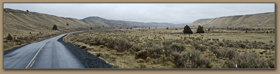
Looking south to the Umatilla Basin from Wallula Gap. Once the flow passed this gap in the Horse Heaven hills, it spread out and filled the huge basin beyond cliffs shown. (Springtime view)

National Park Service map shows huge temporary lakes created when floodwaters were restricted:

Lake Lewis/Wallula Gap

Lake Condon/Columbia Gorge

Lake Allison/Kalama Gap
NPS Map.

Hat Rock State Park Oregon Ice Age Floods.
This Ice Age Floods feature was noted in Clark's journal.

Near Hat Rock on October 18, 1805, William Clark wrote, "Saw a mountain bearing S.W. Conocal form Covered with Snow".

Mount Hood had already been charted by Captain Vancouver's 1792 maritime exploration. Mount Hood became the first landmark viewed by Lewis and Clark that had been charted by other non-native explorers since the expedition left present-day North Dakota.

Palouse Falls in winter.

Hat Rock State Park interpretive display.

Interpretive panel describes the Corps of Discovery's journey down the Columbia River.

Hat Rock in the distance in photo and artwork on display.


Did humans witness the Ice Age Floods?

Panel near Hat Rock State Park shows family running from ice age floodwaters.

View northeast across Lake Wallula.
Lake Wallula Ice Age Floods interpretive display.
Hat Rock State Park location.For more information and directions to the park, visit the official: Hat Rock State Park site. Hat Rock State Park.

Hermiston Butte, Hermiston Oregon.
Hermiston Butte

Columbia Gorge wind farm turbines.

Wind turbines are being erected at a rapid pace in the western Umatilla Basin. The turbines now tower over many ice-rafted erratics and basalt formations shaped by the Ice Age Floods.


Cedar Springs Lane, Ice Age Flood channel
Cedar Springs Lane on flood channel floor.


For more Lake Condon photos and information, visit:

Lake Condon - South Shore Part II


All photos by Tom Foster unless otherwise noted.

HOME Space CONTACT Space SITE MAP IAFI Space LINKS Space © 2008
Ellensburg
Lake Missoula
Lake Lewis
Ice Age Blog
Ice Age Express
Feature of the Month
The Mystery
25 Features
Channeled Scablands
Ice Age Floods Videos
Columbia Gorge
Feature Types
Columbia River Basalt
The Pleistocene
Grand Coulee Project
Washington Wine
Ice Age Floods Inst.
The Bonneville Flood