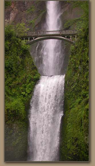
(L to R)Widgoen, Mt. Hood and Columbia Gorge, Columbia Gorge, Multnomah Area Waterfall.
HUGEfloods.com Home Page Not much time? ... Click here for a quick Ice Age Floods summary Ice Age Floods Feature of the month For many years one man understood the clues but no one would listen Glacial Lake Missoula Channeled Scablands of Eastern Washington Temporary Lake Lewis Columbia Gorge Explore the variety of features created by the Ice Age Floods Columbia River Basalt Group The Pleistocene Grand Coulee Dam and the Columbia Basin Irrigation Project Washington Wines Ice Age Floods Institute


Express Tour - Section IV

Through the Columbia Gorge to the Pacific

Summary of the spectacular catastrophic floods that raged through eastern Washington and the Columbia Gorge at the end of the most recent Ice Age

The Columbia Gorge -Ice Age Floods.
The Columbia Gorge


WALLS OF WATER RAGE THROUGH THE COLUMBIA GORGE

Water volumes exceeded the capacity of the gorge near today's John Day Dam, creating another impoundment which backflooded into the Dalles and Umatilla basins. Surging water gouged the walls of the gorge to their modern near-vertical alignment, thereby creating the complex of waterfalls at the gorge's west end. Patches of scabland were created near the Dalles and extensive sand and gravel bars were dropped into the valleys of tributary streams.


View Larger Map
Basalt terraces at Rowena, shaped by the Ice Age Floods.
Basalt Columns, Ice Age Floods.
Multnomah Falls


Basalt Columns, Ice Age Floods.
Columbia River looking east from Rowena Crest, Oregon. Lyle, WA at left.

THE FLOODS RUSH TO THE OCEAN, WHILE BRIEFLY DROWNING
THE WILLAMETTE VALLEY

Rock basin in Drumheller Channels scoured by the Ice Age Floods. Rock basin in Drumheller Channels scoured by the Ice Age Floods.
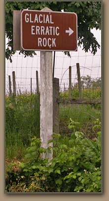
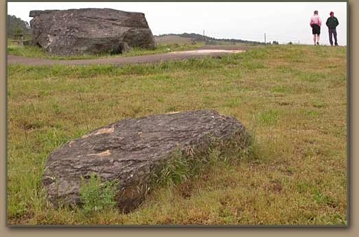
The Bellevue Erratic south of Portland, Oregon.

Pacific Ocean tidepool.
Pacific Ocean tidepool
A check point at Kalama caused the floods to form another temporary lake which flooded the Willamette Valley as far south as Eugene, OR. Large lowland tracts in Washington across the river from Portland also were underwater. The flood crests then dropped rapidly as they reached Astoria and the Ice-Age seacoast 40 miles west of that modern city. Flood debris has accumulated to a depth of 800 feet in the Columbia River's bed west of Astoria.

The Pacific Ocean - Ice Age Floods.
Most of the material removed by the Ice Age Floods was carried into the Pacific Ocean.


Ice Age Floods Express Tour: Continue

Section I
Lava Flows
Ice Age
Section II
Ice Dam
Lake Missoula
Section III
Scabland Floods
Wallula Gap
Section IV
Columbia Gorge
To the Pacific
Section V
Evidence
Solving the Mystery

All photos by Tom Foster unless otherwise noted.

HOME Space CONTACT Space SITE MAP IAFI Space LINKS Space © 2008
Ellensburg
Lake Missoula
Lake Lewis
Ice Age Blog
Ice Age Express
Feature of the Month
The Mystery
25 Features
Channeled Scablands
Ice Age Floods Videos
Columbia Gorge
Feature Types
Columbia River Basalt
The Pleistocene
Grand Coulee Project
Washington Wine
Ice Age Floods Inst.
The Bonneville Flood