
|
|
|
|
|
|

 "Missoula Flood, Lake Lewis rhythmites near Zillah Washington (Interstate 82) - Click to view")
|
 "Ice-rafted erratic cluster on Goose Hill. - Click to view")
|
 "Ice-rafted erratic on Rattlesnake Slope - Click to view")
|
 "Badger living in slackwater flood deposits. - Click to view")
|
 "Geologist/Author Bruce Bjornstad on Badger Coulee erratic. - Click to view")
|
|
Lake Lewis Ice Age Flood as it began to recede through Wallula Gap. Painting by Stev H. Ominski |

"Like roads to Rome, all scabland rivers led to Pasco Basin." J Harlen Bretz |
LAKE LEWISWhen Lake Missoula's ice dam failed, floodwaters gushing to the southwest quickly overwhelmed or bypassed everything that stood in their way--until these torrents funneled into the Pasco Basin. The result was Lake Lewis. Named for explorer Meriwether Lewis, this lake might be described as an Ice Age version of a gigantic stormwater runoff retention pond. This huge pond filled and emptied dozens of times. |  | |
|
The choke point that created Lake Lewis was the Horse Heaven Hills region just south of present-day Pasco, Wash. This range of basalt hills, which includes ridges whose elevations reach 2,000 feet or higher, is breached by the Columbia River at Wallula Gap. The gap is the only natural outlet for stream flows from the entire Columbia River Basin of eastern Washington. These terrain features were in place long before the Lake Missoula floods of 15,000-20,000 years ago. [The National Park Service has named Wallula Gap a National Natural Landmark, owing to its geographic significance.]

| ||
|
During each of the Lake Missoula flood episodes, as much as 200 cubic miles of water per day might accumulate in the low country north of Wallula Gap. This created a temporary lake level of 1,200 feet elevation. Since Wallula Gap could only disgorge about 40 cubic miles of water daily, one or two weeks might elapse before Lake Lewis' flood water was drained from the basin. Outflows from the gap also were retarded as the Columbia River was slowed at similar choke points downstream--such as the narrows at Crown Point, east of Troutdale, Ore.
A 3,000-SQUARE MILE "RETENTION POND" | ||
|
Lake Lewis covered the entire Pasco Basin, most of the Quincy Basin, and Yakima Valley, much of the Ahtanum Valley, and the valley of the Walla Walla River and its main tributaries. Floodwaters also backed up the Snake River well beyond present-day Lewiston, Idaho. An estimated 3,000 square miles of land were under water. | ||
The locations later occupied by the region's principal cities all were submerged. Pasco and Richland would have been under 800 feet of water, and the only dry ground in the nearby area was atop a handful of promontories--Badger, Candy, and Red mountains, as well as Goose Hill. [Geologists refer to these high points as the "Lake Lewis Isles".] |
 "Lake Lewis Isles by Bjornstad - Click to view")
| |
Today's Walla Walla would have been covered by 50 feet of water, and Yakima would have been inundated by overflows backing up through Union Gap into the Ahtanum Valley. The vicinities of Quincy and Ephrata would have marked the temporary lake's northern limit, while much of the Saddle Mountains and Rattlesnake Hills, along with the upper elevations of Frenchman Hills, remained above the water line. | ||
Geologic evidence suggests that Lake Missoula floods occurred at least 89 times, and Lake Lewis would have functioned as a temporary impoundment during most if not all of these events. But many geologists believe that there were many more floods--some of them from sources other than Lake Missoula, and others taking place at much earlier dates than the Lake Missoula floods. If so, Lake Lewis probably existed at these times as well, because the Columbia Basin, its rivers, the Horse Heaven Hills, and Wallula Gap all predated the Pleistocene Ice Age. | ||

 "Rattlesnake Slope Erratic - Click to view")
|
|

Hiker stands atop Lake Lewis rhythmites - Hanford Reach National Monument.
Click arrow above to play short video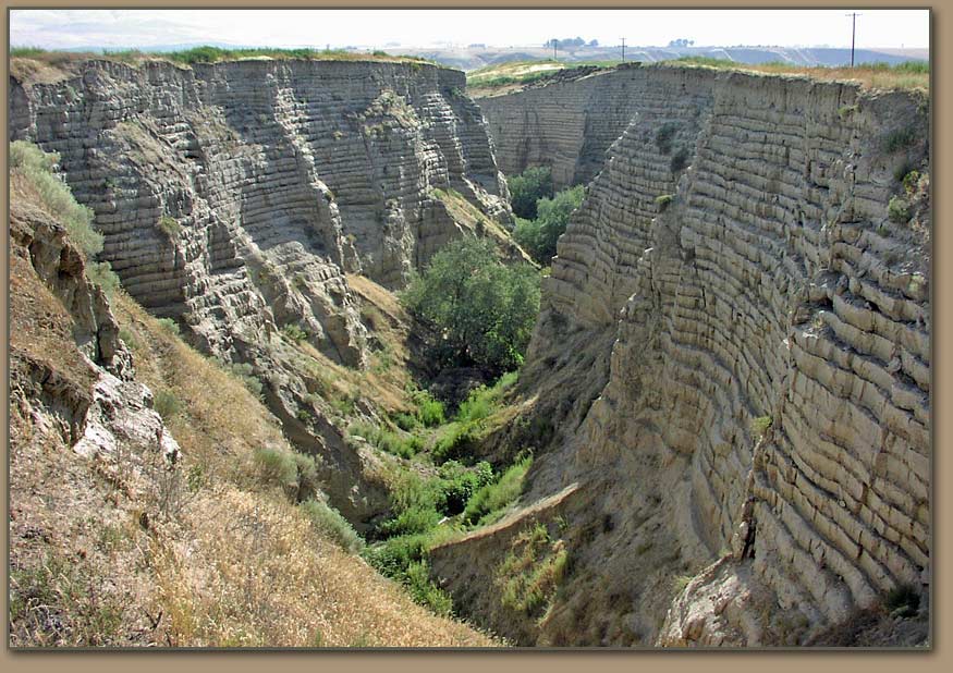
 Lake Lewis at approximate high water level - 1,250 ft.Major Ice Age Flood tracts - brown arrows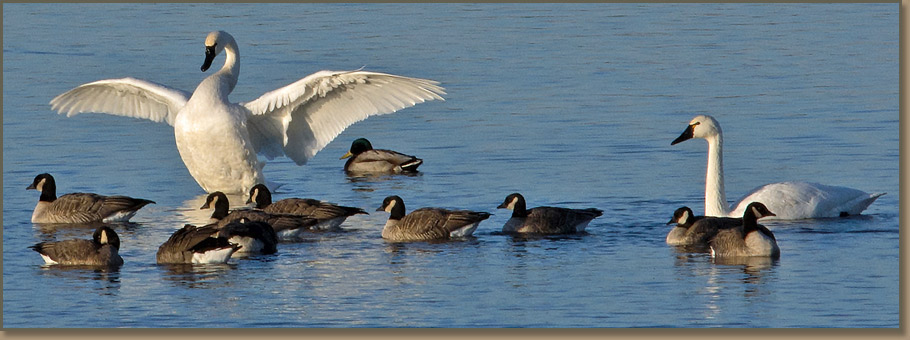
Tundra swans at McNary National Wildlife Refuge
 Hanford Reach Interpretive Center on the Columbia River
|

|

|
 Many of Washington State's premium wines are created with grapes sourced from vineyards within the Lake Lewis basin.  Marker placed at 1,250 Elev. along Badger Mountain trail. |
Between fillings - Farmers produce crops that help feed the world on the floor of Lake Lewis.Without irrigation water, farmers in the Quincy and Pasco basins would be limited to "dry land" crops due to the fact that much of the areas 6 to 10-inch annual precipitation arrives outside of the growing season. Following development of the Columbia Basin Irrigation Project and other systems, the area once inundated by the waters of Lake Lewis encompasses some of the most productive farmland in the world. Slackwater flood sediments mixed with windblown deposits combine to create fertile well-drained soils with the capacity to produce high value crops. Area food processors package and market the quality fruits, vegetables and grains produced during the region's long growing season . Well established transportation systems move products produced to domestic markets as well as world markets through the ports of Vancouver, Portland, Tacoma and Seattle.  |
|
Links:
Lake Lewis Wikipedia page. Ice Age Flood Features in the Vacinity of the Pasco Basin and the Hanford Reach National Monument. Tri Cities Area Ice Age Floods Tour Map. |


 and clastic dikes.")

 Ice-rafted erratics pushed to perimeter of Richland, WA housing development.